Overview
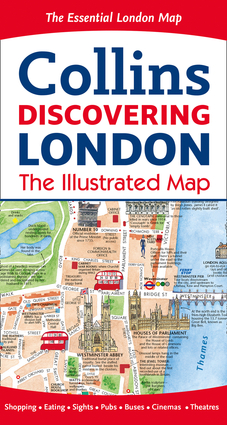
This hand-watercolored map contains individual paintings of all the main sites and landmarks, shop-by-shop street maps, theatres and cinemas, comprehensive travel information and index. At a scale of 1:8,250 (7.5 inches to 1 mile). Coverage extends from Regent’s Park in the north to Battersea in the south, and from Kensington in the west to Tower Bridge in the east. Features hop-by-shop street maps for Oxford Street, Bond Street, Covent Garden, Portobello Road, King’s Road, Brompton Cross, Exmouth Market, Beauchamp Place, St. Christopher’s Place and South Molton Street, Knightsbridge, Jermyn Street and Kensington.
Author Biography
Explore the world through accurate and up-to-date mapping with Collins UK.


